


The GGIS is the Global Groundwater Information System, an online platform supporting the sharing of groundwater data and information worldwide. Since 2004, it provides groundwater users, professionals and managers with data and information on this hidden yet crucial resource. Access GGIS here.
The current version of the GGIS was launched in January 2021. As in previous versions, it supports the sharing of map layers and documents. In addition, the GGIS now includes a section for sharing well data and groundwater monitoring data. Before, groundwater monitoring data were shared in a separated application, the GGMN Portal. Joining together maps, well and monitoring data and documents into one platform will facilitate their sharing and interpretation.
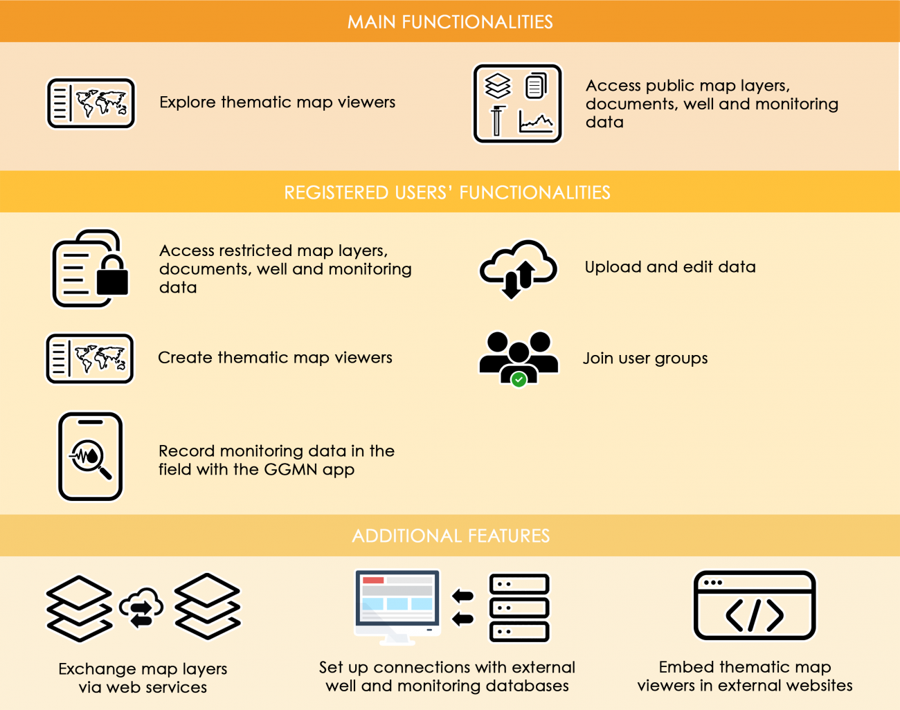
Another breakthrough is that the GGIS now operates as a Spatial (and temporal) Data Infrastructure (SDI), where several individuals and organisations can connect for sharing data. All users have the possibility to register for uploading data, accessing restricted data or creating map viewers. When uploading data in the GGIS, users can determine a.o. which other users or user groups have the permission to visualize or to download the data. They can also assign licenses to their data. Therefore, data providers remain always in control of their data.
These new developments give the opportunity to the entire groundwater community to participate in the sharing of data and information.